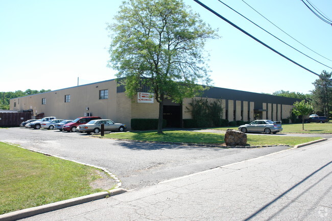
Property Record
39 Progress St, Edison, NJ 08820

This Property Is For Sale
NEARBY LISTINGS FOR SALE OR LEASE
Property Detail
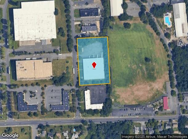
39 Progress St
New York-Jersey City-White Plains, NY-NJ
Inman Avenue Industrial Park
05-00412-01-00016-01
3.03 AC
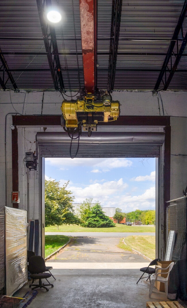
Industrialgeneral
Middlesex
AE
New Jersey
34023C0051F
16.1
2024
3.03 AC
2025
Exit 10
001411
Northern New Jersey
DEMOGRAPHICS near 39 Progress St
1 Mile
3 Mile
5 Mile
2024 Total Population
12,087
107,875
396,843
2029 Population
11,976
107,466
393,547
Pop Growth 2024-2029
(0.92%)
(0.38%)
(0.83%)
Average Age
42
42
40
2024 Total Households
3,977
36,087
137,057
HH Growth 2024-2029
(0.98%)
(0.44%)
(0.90%)
Median Household Inc
$149,568
$134,683
$110,943
Avg Household Size
3.00
2.90
2.80
2024 Avg HH Vehicles
2.00
2.00
2.00
Median Home Value
$569,411
$517,346
$452,821
Median Year Built
1984
1965
1960
Nearby Places
Map Layers
Map Styles
 Street
 Aerial
- Restaurants
- Banks
- Shops
- Fitness
- Groceries
PUBLIC TRANSPORTATION
COMMUTER RAIL
Metropark (Northeast Corridor Line - NJ Transit Commuter Rail (NJ Transit))
DRIVE
WALK
Distance
Metropark (Northeast Corridor Line - NJ Transit Commuter Rail (NJ Transit))
8 min
3.5 mi
Netherwood (Raritan Valley Line - NJ Transit Commuter Rail (NJ Transit))
DRIVE
WALK
Distance
Netherwood (Raritan Valley Line - NJ Transit Commuter Rail (NJ Transit))
10 min
4.6 mi
AIRPORT
Newark Liberty International
DRIVE
WALK
Distance
Newark Liberty International
26 min
17.4 mi
LaGuardia
DRIVE
WALK
Distance
LaGuardia
60 min
36.7 mi
Freight Ports
New York Container Terminal
DRIVE
WALK
Distance
New York Container Terminal
24 min
13.1 mi
Nearby Properties
Address
Land Use
TOTAL SIZE
Lot Size
Zoning
Address
Land Use
TOTAL SIZE
Lot Size
Zoning
37.46 AC
EI
Address
Land Use
TOTAL SIZE
Lot Size
Zoning
10.11 AC
Address
Land Use
TOTAL SIZE
Lot Size
Zoning
80,000 SF
23.37 AC
R50
Address
Land Use
TOTAL SIZE
Lot Size
Zoning
19.90 AC
P
Address
Land Use
TOTAL SIZE
Lot Size
Zoning
96.22 AC
RA
Address
Land Use
TOTAL SIZE
Lot Size
Zoning
5,645 SF
91.16 AC
O
Address
Land Use
TOTAL SIZE
Lot Size
Zoning
9.98 AC
RA
Address
Land Use
TOTAL SIZE
Lot Size
Zoning
102,200 SF
6.68 AC
RA
Address
Land Use
TOTAL SIZE
Lot Size
Zoning
5.83 AC
RO
Address
Land Use
TOTAL SIZE
Lot Size
Zoning
19.50 AC
LR
Address
Land Use
TOTAL SIZE
Lot Size
Zoning
6.10 AC
RO
Address
Land Use
TOTAL SIZE
Lot Size
Zoning
66,900 SF
12.75 AC
Address
Land Use
TOTAL SIZE
Lot Size
Zoning
18.61 AC
Address
Land Use
TOTAL SIZE
Lot Size
Zoning
227,149 SF
7.69 AC
IL
Address
Land Use
TOTAL SIZE
Lot Size
Zoning
11.49 AC
RO
Address
Land Use
TOTAL SIZE
Lot Size
Zoning
261,144 SF
10.14 AC
OR
Address
Land Use
TOTAL SIZE
Lot Size
Zoning
10.91 AC
OR
Address
Land Use
TOTAL SIZE
Lot Size
Zoning
22 AC
P
Address
Land Use
TOTAL SIZE
Lot Size
Zoning
2,795 SF
137.05 AC
Address
Land Use
TOTAL SIZE
Lot Size
Zoning
20.27 AC
PB
Address
Land Use
TOTAL SIZE
Lot Size
Zoning
17.63 AC
LR
Address
Land Use
TOTAL SIZE
Lot Size
Zoning
43.03 AC
R-1
Address
Land Use
TOTAL SIZE
Lot Size
Zoning
270,312 SF
8.10 AC
OR
Address
Land Use
TOTAL SIZE
Lot Size
Zoning
1.46 AC
GB
Address
Land Use
TOTAL SIZE
Lot Size
Zoning
18.03 AC
LR
Address
Land Use
TOTAL SIZE
Lot Size
Zoning
16.69 AC
LR
Address
Land Use
TOTAL SIZE
Lot Size
Zoning
5.46 AC
RA
Address
Land Use
TOTAL SIZE
Lot Size
Zoning
105,755 SF
4.66 AC
IL
Address
Land Use
TOTAL SIZE
Lot Size
Zoning
1,092 SF
85.80 AC
Address
Land Use
TOTAL SIZE
Lot Size
Zoning
5.48 AC
RO
The World's #1 Commercial Real Estate Marketplace
Connect with us
© 2025 CoStar Group
The information above has been obtained from sources believed reliable. While we do not doubt its accuracy we have not verified it and make no guarantee, warranty or representation about it. It is your responsibility to independently confirm its accuracy and completeness. Any projections, opinions, assumptions, or estimates used are for example only and do not represent the current or future performance of the property. The value of this transaction to you depends on tax and other factors which should be evaluated by your tax, financial, and legal advisors. You and your advisors should conduct a careful, independent investigation of the property to determine to your satisfaction the suitability of the property for your needs.